|
| |
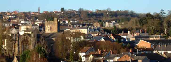
The Rape of The Ruffets
|
 |
| (A public meeting was held Thursday 22
September 2005 in the Methodist Church, Chepstow) |
|
If you have Google Earth installed, you can double-click and
fly to The Ruffetts.
If not, you will need to
install Google Earth first (available at http://earth.google.com). |
|
After considerable opposition, final planning permission
was
reluctantly granted by Monmouthshire County Planning Committee in
2003 for an obtrusive high density development on the unsuitable,
narrow, rocky slope of the Ruffets, a prominent green, wooded area of
Chepstow, Monmouthshire, which it had been hoped would remain as an
amenity and wildlife habitat. The impression that we in
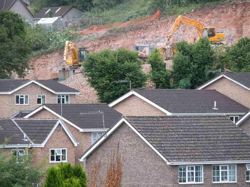
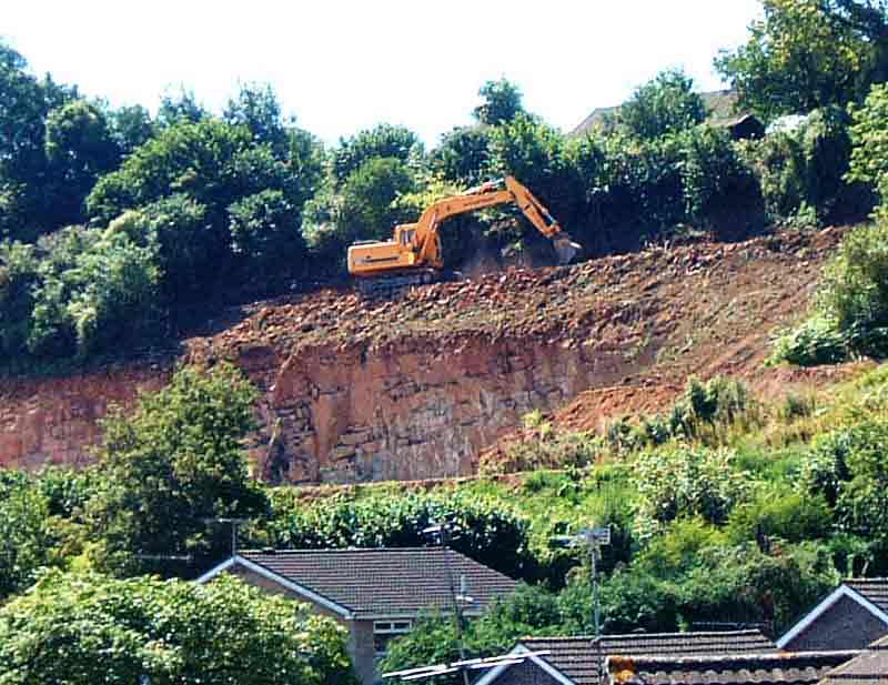
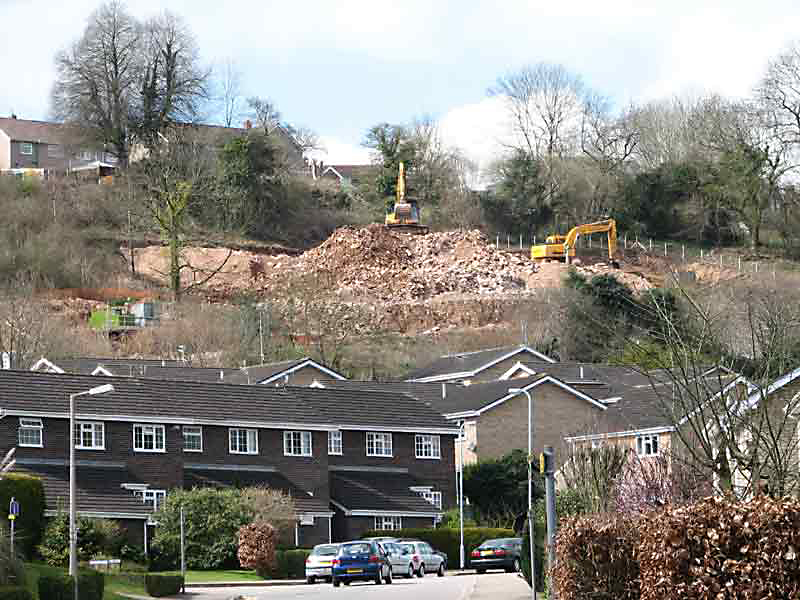
the vicinity now have is that it has become a quarry. The following photographs were taken 19 July 2005 after
weeks of heavy drilling machinery noise from
about 800 yards away
(caution download file is 465Kb) from the site between the hours
of 8am and 6pm, Monday to Friday. |
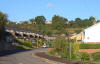 |
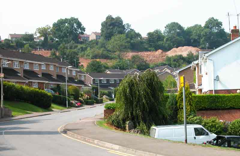
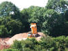
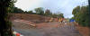
The area affected, from the bottom of St Kingsmark Avenue,
July 2004, before the desecration started. |
 |
and now (19 July 2005) |
 |
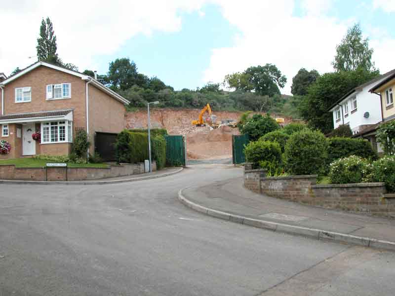
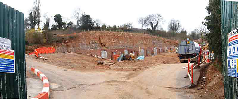
The site entrance from Meadow Walk |
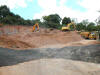 |
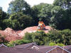
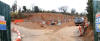
The view of the site from the site entrance. It has the appearance
of a quarry in the middle of a housing estate. |
 |
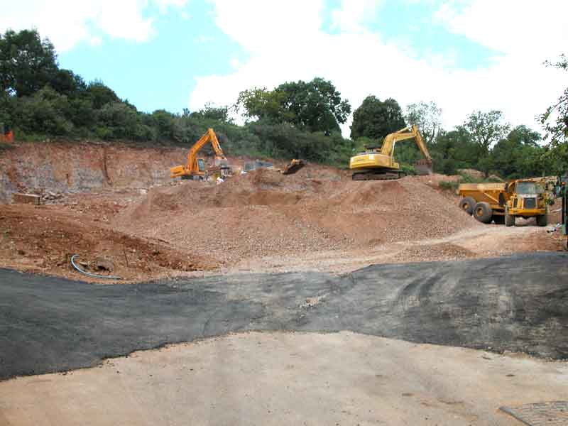
Another view from the site entrance showing one of the
trucks returning. |
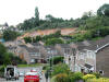 |
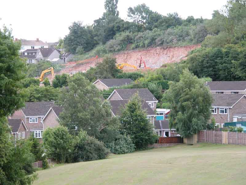
A view from St Kingsmark Avenue |
 |
Another view from higher up St Kingsmark Avenue |
 |
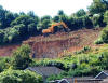
A closer view from St Kingsmark Avenue |
 |
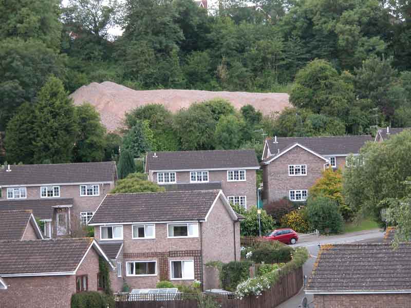
This heap of spoil is at the western end of the
development. |
 |
A view from lower St Kingsmark Avenue on 2 August 2005 |
 |
A view from lower St Kingsmark Avenue on 2 August 2005 |
 |
A view from St Kingsmark Avenue on 8 August 2005 |
 |
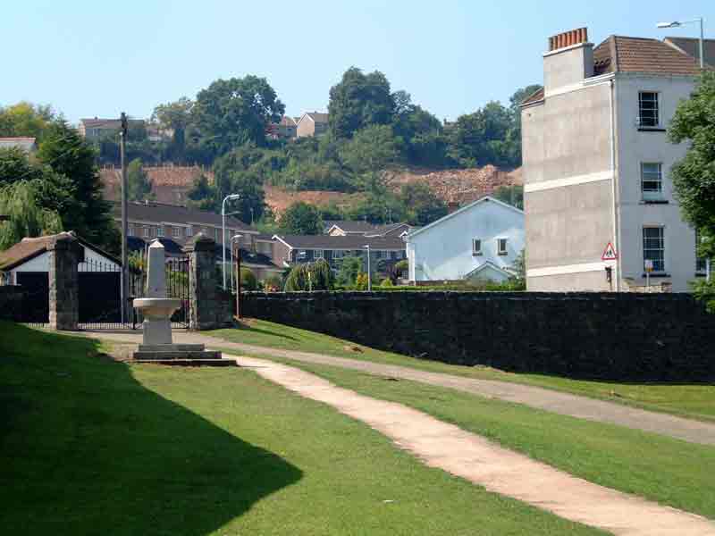
A view from The Dell on 17 August 2005.(the fountain
has since lost its top) |
 |
A view from the new road bridge with St Mary's Church in
the picture |
 |
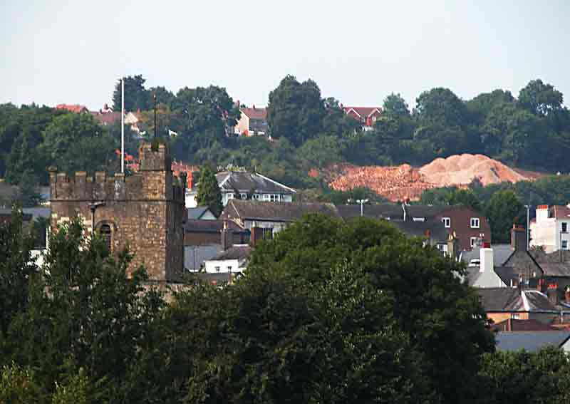
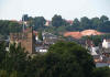
A view from Tutshill over the castle on 18 August 2005 |
 |
Another view of the Ruffets from Tutshill |
 |
view from the site entrance in Meadow Walk |
The noise started again, after a week or so of
quiet, on the morning of Wednesday 2 November 2005, when these two
photographs were taken |
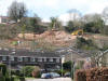 |
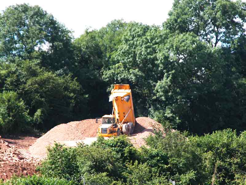
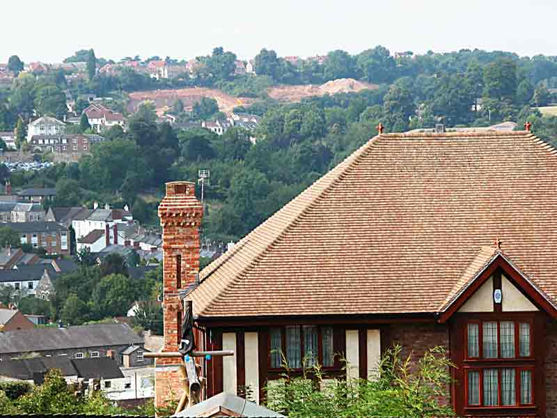
A view taken 10 April 2006 |
 |
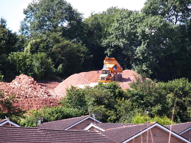
Taken 13 April 2006. Some buildings appear amongst the
rocks |
| |
|
|
This example of democracy not working raises numerous questions. For
example:
- Why should the will of the majority affected by this development be
disregarded? This is a local issue in which the rest of the inhabitants
of the UK have no interest - why should an "Inspector" be involved and
be able to overrule a Local Authority decision? In short, why is a
distinction not made between purely local projects and national
projects?
- Why, when planning permission is granted, is a time limit not
applied for completion? The need for the development may disappear (as
in this case, when the sacrosanct A466 development boundary was broken).
- Why does the planning permission not lapse if the land is sold on?
- Indeed why, when planning permission is granted, does the enhanced
value of the land go to the applicant and not to the Local Authority?
- Why, when a planning application is turned down, or an appeal
rejected, is there not a time limit before another application can be
made? (e.g. 5 or 10 years)
- Why is legal aid not available to the objectors to balance the
benefits which winning planning permission gives to the applicant? (The
applicant could pay for this).
|
At 7:30 PM on on 22 September 2005, a Public Meeting was held in the
Methodist Church, Chepstow to discuss the Ruffets.
|
No representative of the Developer was present. As
the speakers addressed the meeting it quickly became apparent that
whilst they had sympathy and understanding, Planning Law is such that
nothing could be done to save the Ruffets. There was a determined
reluctance to accept that the site has become a quarry. It is,
apparently, considered normal for a developer to sell material from a
building site. It is also considered normal for a developer to make more
noise, and create more dust, than would be allowed from a quarry.
The best that could be
achieved was to prolong the operations. Even if the Developer had not
complied with the planning consent, all that he needed to do was to
re-apply. The implication being that consent would be given for the
change.
For example, it appears that the Developer has given notice that
he would like to change the design of the homes and would be providing
more information later. The planning representative indicated that if
these changes did not alter the size of the "footprint" of each house
(for example), he would agree the change.
It was also accepted that the depth of the excavation and the
height of the consequent cliff face was a surprise but, perhaps, the
survey of the site was wrong. (It has to be remembered that the Developer
has had plenty of time to get the survey done properly - this
application was over 30 years in the making! ). The Planning
representative stated that so long as the houses were in the same place,
nothing could be done.
What sort of spineless planning control is this?
It was not explicitly stated: but the use of gabions to retain the
cliff side of the excavations appears to be no longer contemplated.
Since these were a very obvious part of the application which was
agreed, how can this happen without reference back to the planning
committee? There was no indication at the meeting that this change from
using gabions was considered anything other than a minor one to be
"given the nod".
In my view this would be a major change. Using gabions meant
there would be no dangerous vertical precipice as we see it now. The
plans show a sloping face which vegetation would in time cover. The
hazard and environmental impact would be far less.
The Developer should be advised strongly that he must proceed in
accordance with the approved plan or that work on site be stopped until this
fundamental aspect of the development is clarified. The application
might then have to be referred back to the planning committee who perhaps then could use their
powers to stop this desecration of Chepstow's environment.
Point 4 in the document below should digested by our elected
representatives and steps taken to change Planning Law more in favour of
the environment and those affected.
A lot is heard nowadays about democracy in Iraq; a little more of
it is required nearer home.
|
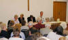 |
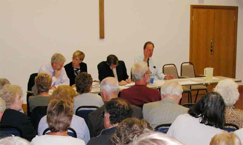
My voice recorder failed so I am not absolutely sure
of the names of all the speakers, but from left to right in the
photo I believe are: David Swanson, Head
of Development Control, Monmouth C.C., Mrs Kim Pugh, Environment
Health Manager, Monmouth C.C.,
David Davies AM, MP, and Steve Clark from
Gwent Badger Group (Chair). |
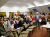 |
The meeting was well attended. Even more arrived
after this photo was taken. For quite a few, this was the first time
they had become involved, judging by the show of hands in response to
the chairman's question. |
| |
| An A4 sheet was given to all those attending which
is reproduced below: |
|
This meeting is a response by local people to strong
feelings caused by the Ruffets housing/quarrying development. We're very
grateful to our speakers for trying to help us to understand the present
very difficult situation, and who are determined to find solutions to
the problems.
Aims of the meeting
1: This is a unique development which requires a
unique solution. Our ultimate hope is that the development will now
stop and revert to the previous planning permission of building five
houses. The remaining hillside would need to be restored and secured for
safety, and would then become public open space as previously desired by
Monmouthshire County Council.
2: We would like MCC to commission an independent
survey of the site. The huge mounds of rock and the quarried void
and unsecured cliff face are causing genuine concern to people who live
above them and in their shadow. The quarry area is planned to extend for
a considerable distance beyond its current size. Safety and geological
issues need to be addressed. Deafening noise, vibration and dust are
causing intolerable health issues.
3: Democracy has failed local people up to now.
Residents, wildlife supporters, politicians and the
MCC aIl campaigned for years to
protect this special hillside. ONE man a Planning Inspector decided he
knew what was best for our community - more housing. The overpowering
will of Chepstow people is that quarrying activities to remove a
hillside in a residential area must be-stopped at once. Hopefully
democracy will have a positive effect now.
4: Planning law needs to be
changed - there should be an opportunity for
County Councillors to review land use periodically without
incurring great costs at public enquiries when they do try to do so.
Outline Planning Permission given for housing in 1973 should not dictate
what happens in an evolved community thirty years later.
Thanks to everyone for coming this evening. Your energy
and commitment in trying to improve conditions in this community are our
real chance for things to improve long term here and in other
communities with similar problems.
If you haven't written to your MP to voice your views,
please take a few minutes to do so:
David Davies AM, MP, House Of Commons, London SW1A 0AA
daviesd@parliament.uk
Also please write the same letter to the following:
Mr S Greenslade, Corporate Director: Environment,
Croesyceiliog, Cwmbran, NP44 2XH Monmouthshire County Council, County
Hall.
Carwyn Jones AM, Assembly Minister for Environment,
Planning and Countryside, National Assembly For Wales,
Cardiff Bay, Cardiff
CF99 19A. |
10 November 2005:
Another example of this failure of democracy has occurred in Lydney. Forest of
Dean District Councillors have reluctantly given planning permission for a
controversial development of 47 houses. The reason why they approved the
application by a narrow margin of eight votes to seven was a fear that failure
to grant permission would inevitably lead to an appeal, the costs of which would
have to be recovered from Council Tax.
Return to top
|