

|
|
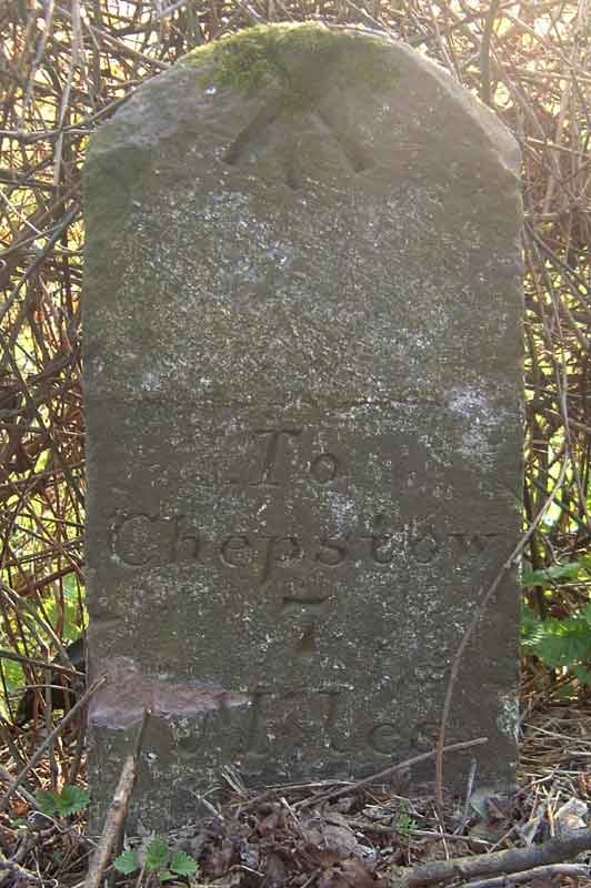
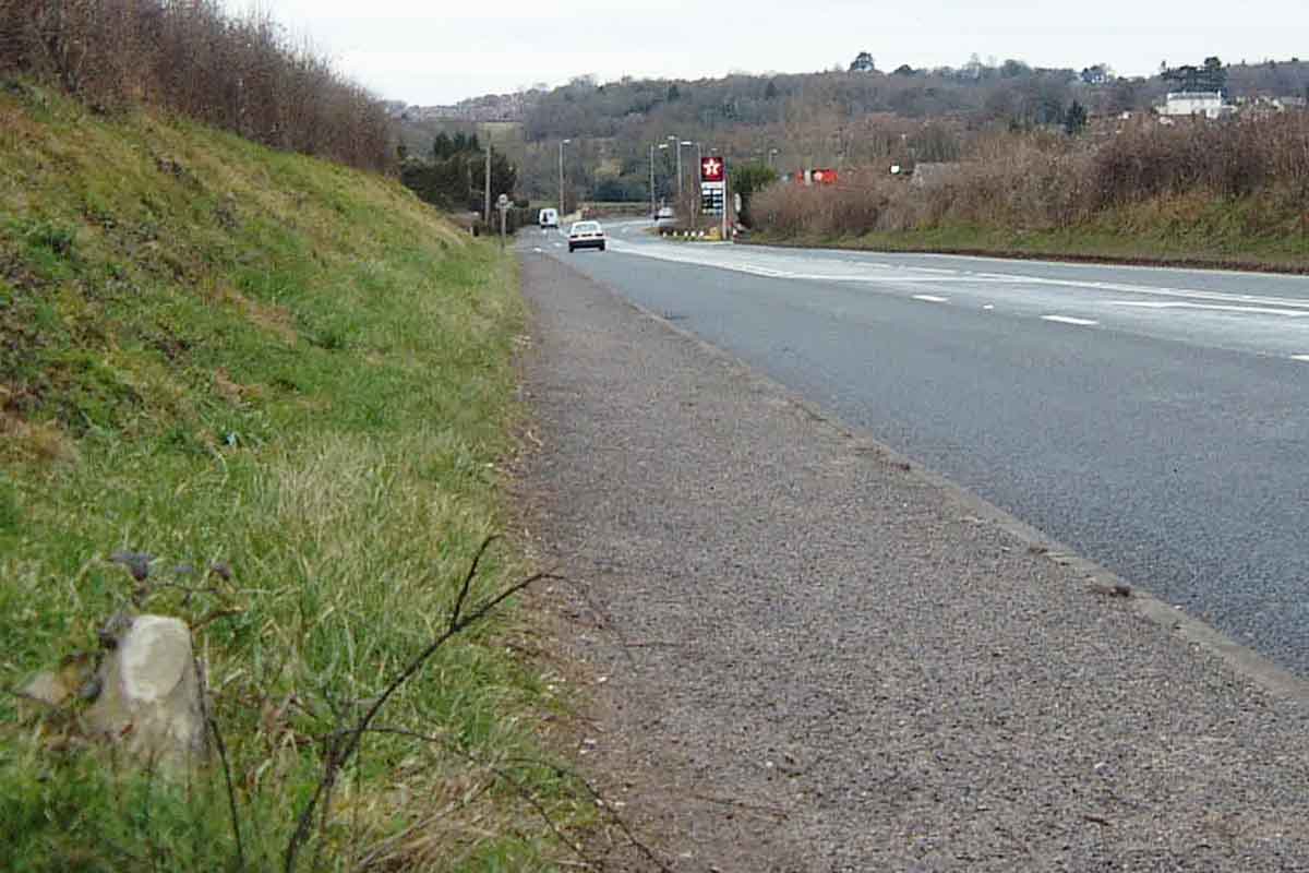
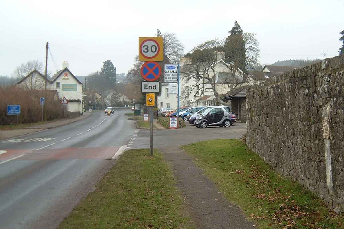
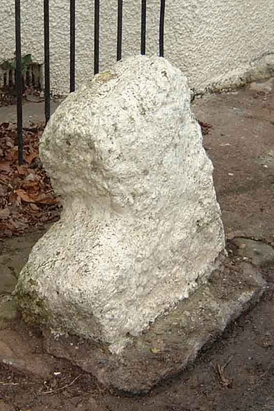
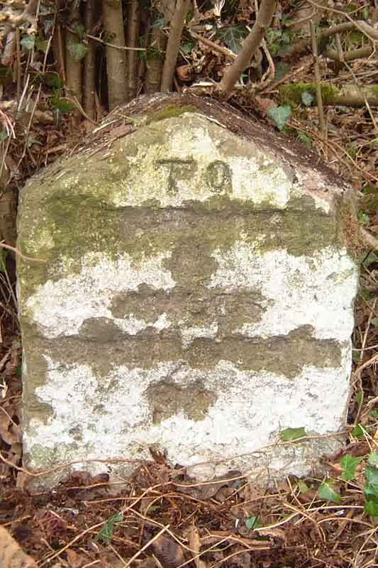
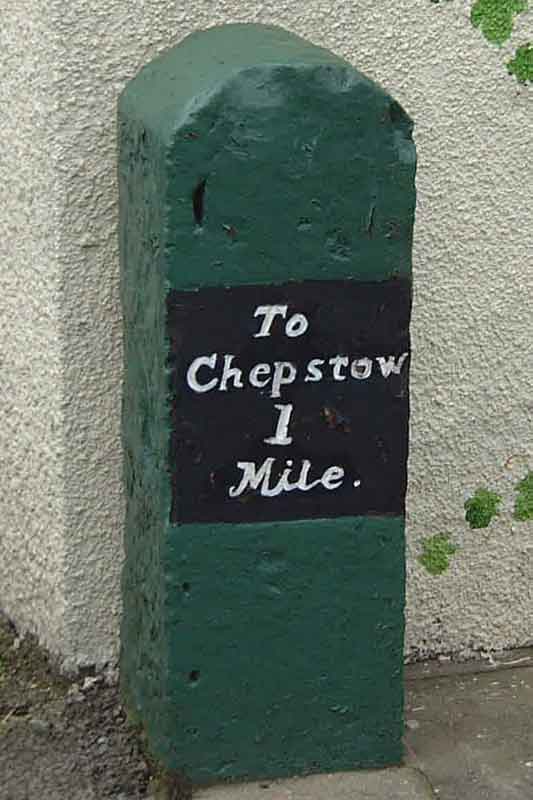
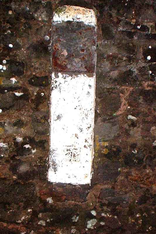
Chepstow Milestone Plate Missing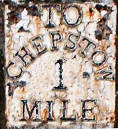 Just after Christmas 2001, the cast-iron plate on one of the remaining "1 Mile to Chepstow" milestones went missing. The milestone is set into the racecourse wall about a 100 yards above the Racecourse roundabout (ST 52250 94756). There were signs that it had been levered-off. Vandalism or theft? It's not clear. Chepstow has lost a part of its heritage. The milestone had served its useful purpose probably since the end of the 18th century. If you know where it is, please contact The Milestone Society
More about Chepstow's milestones. And that they do go missing, check this.
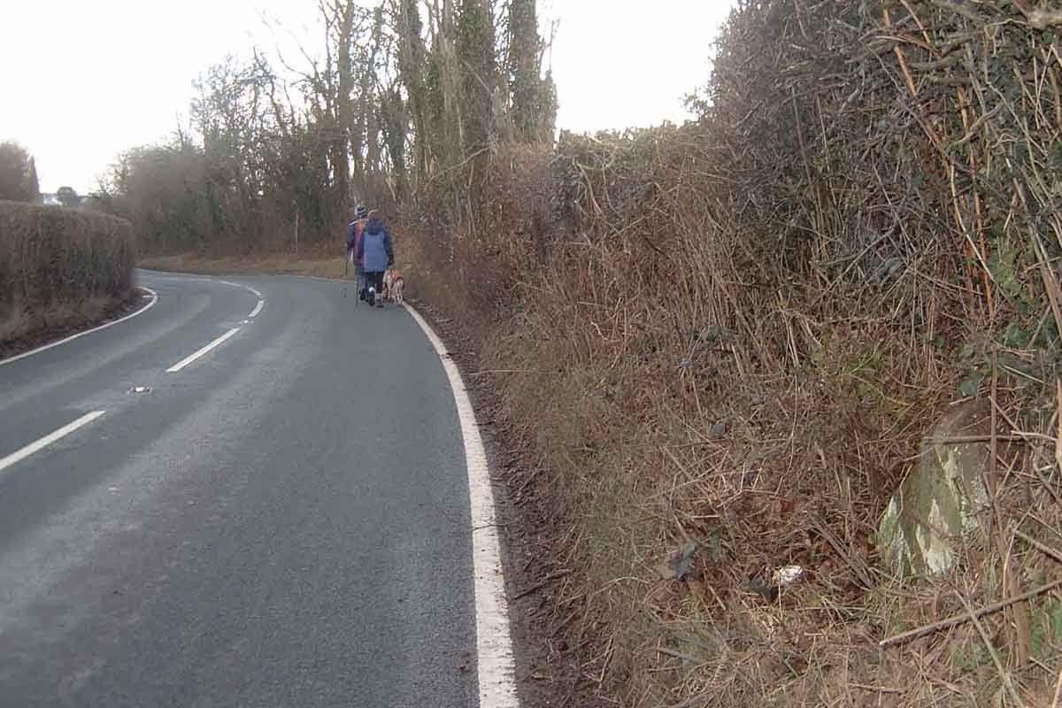
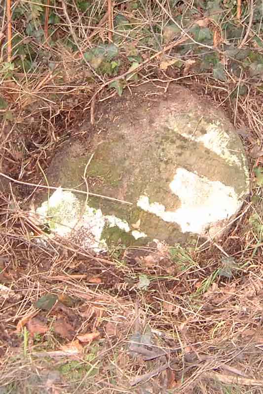
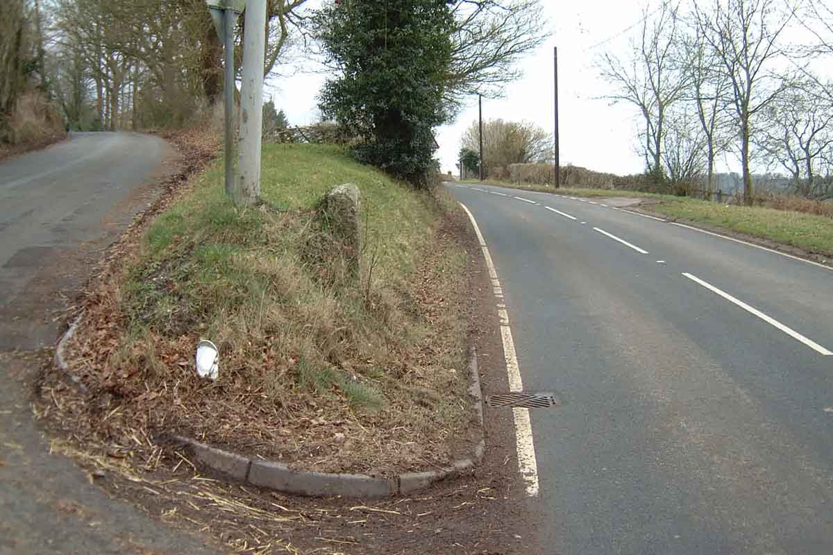
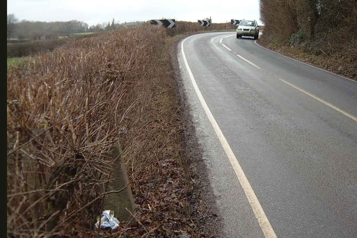
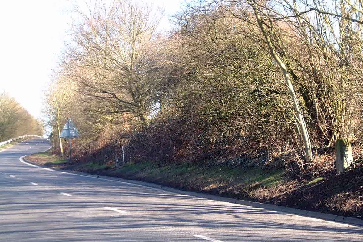
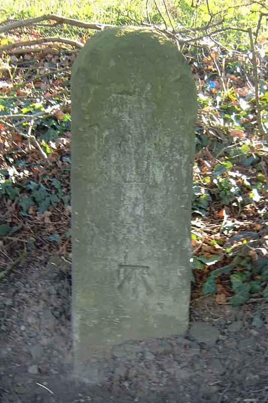
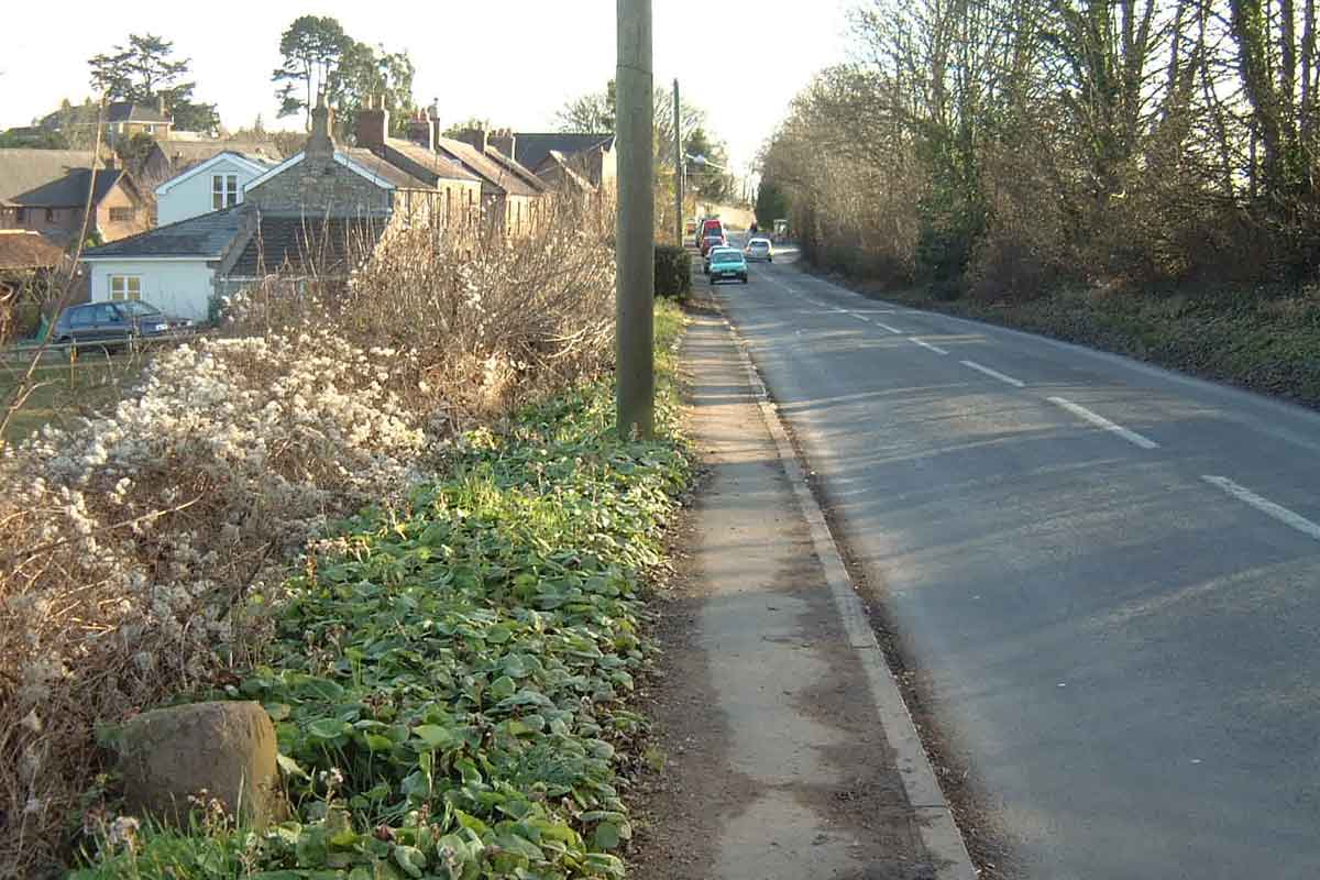
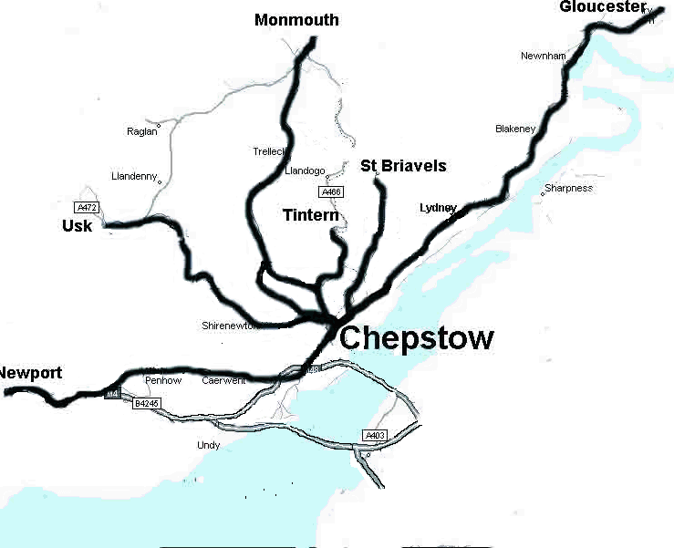 These relics of an era when Monmouthshire first had passable roads are now very neglected. The following is my attempt to locate any remaining ones in the area around Chepstow, Monmouthshire. Distances were measured from the Beaufort Arms Hotel in Chepstow. The 1886/1889/1891 Ordnance Survey maps gave the milestone locations using the letters MS and gave the distances from towns. Some milestones appear to have been moved subsequently as evidenced by their found location and/or their position as marked on the modern OS Explorer maps. Some milestones appear to have been lost, some have been defaced - probably when fear of invasion was as its height in 1940. It is possible that some still lie buried, if that was the chosen method of hiding the information from the potential invader. Certainly they are deteriorating and are increasingly under threat as the road verges vanish beneath the weight of traffic. Set out below are the results so far of a survey of the milestones around Chepstow. Where no photograph exists, I have yet to determine that the milestone is still in place. If anyone is minded to use the indicated location coordinates to check a milestone, please take care!
A48 Chepstow to NewportMilestone
Location Grid Ref
Description
Location Photograph
Close-up Photo
1886 OS
Modern OS Explorer
Current Location
1
352376 192842
2
351268 191780
351240
191779 351235 191789 On the left verge approaching Chepstow, outside the Garden Centre. It appears to have once had a plate attached.
3
350401 190517
350375 190490
(Pathfinder) Parkwall
4
Crick
5
347280 190436
347255
190439 347265 190435 On the Chepstow side of the crossroads in Caerwent. On the left verge approaching Chepstow. It appears to have once had a plate attached.
6
7
344157 191125
8
342667 191048
The Chepstow side of Penhow Castle
9
341039 191288
London 140 Chepstow 9 Newport 7,
At Cross Wen Inn 10
339473 191034
London 141 Chepstow 10 Newport 6.
11
338128 190327
338107 190316
London 142 Chepstow 11 Newport 5. At Langstone
12
336710 189781
London 143 Chepstow 12 Newport 4
Hurran's Garden Centre 13
335247 189159
335212 189111
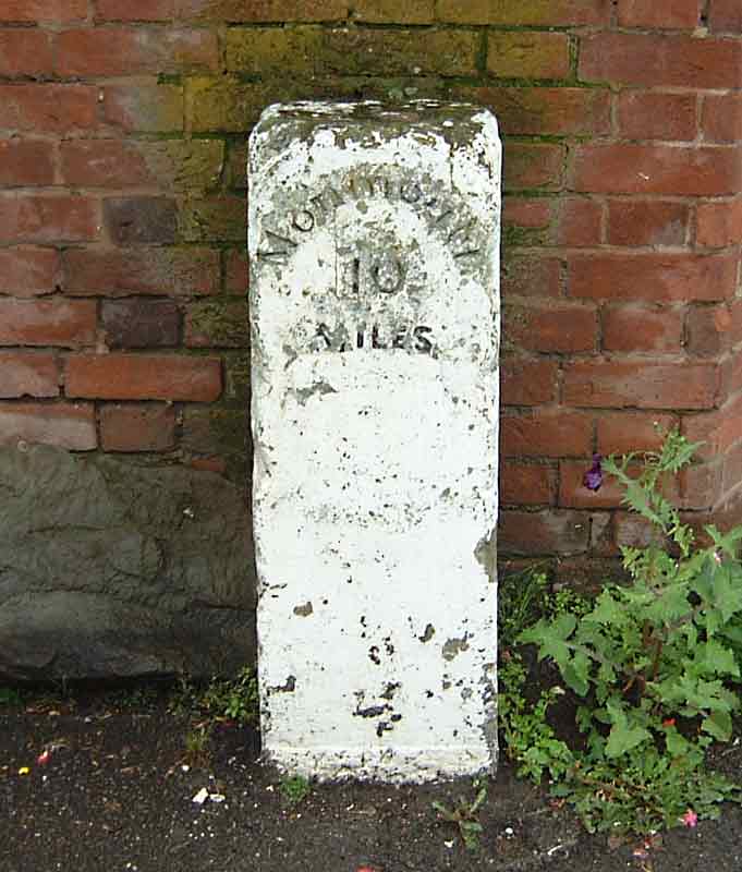
MP London 144 Chepstow 13 Newport 3.
14
333909 188291
London 145 Chepstow 14 Newport 2
15
A466 Chepstow to St ArvansMilestone
Location Grid Ref
Description
Location Photograph
Close-up Photo
1886 OS
Modern OS Explorer
Current Location
1
352254 194762
352256 194758
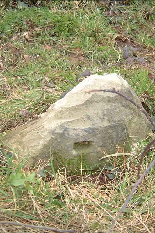
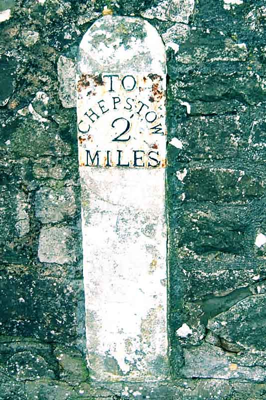
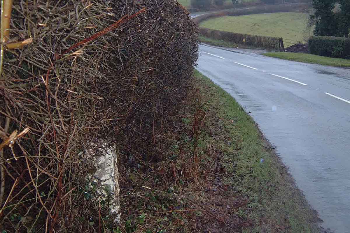
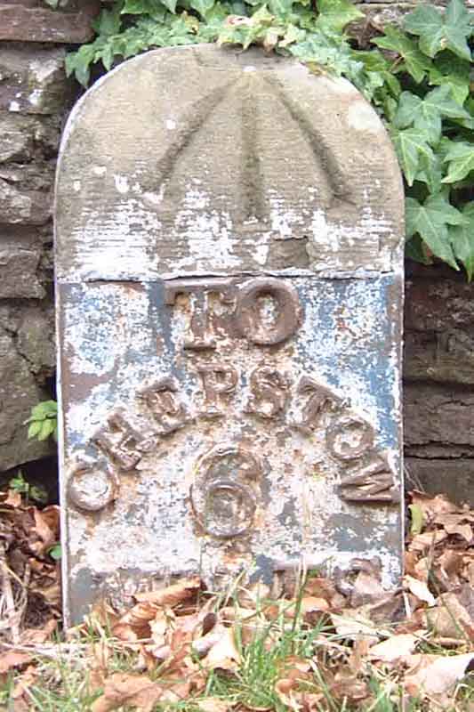
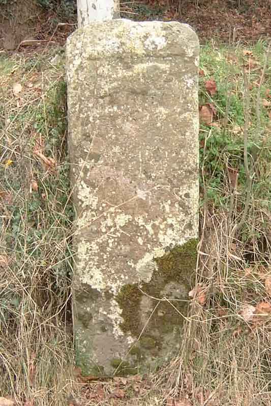
352256 194758 Set into the racecourse wall about 100 yards above the Racecourse roundabout. Plate went missing just after Christmas 2001
2
351939 196297
351949 196295
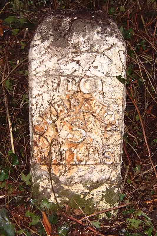
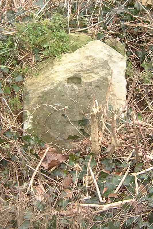
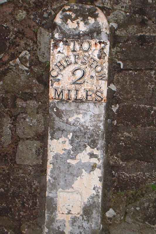
351949 196295 Set into the Chepstow Racecourse wall a few yards from St Arvan's Garage.
A466 St Arvans to Monmouth road via Tintern and Llandogo.Milestone
Location Grid Ref
Description
Location Photograph
Close-up Photo
1886 OS
Modern OS Explorer
Current Location
3
352834 197237
not on map
352834 197237 The lower Wyndcliffe picnic spot can be seen in the distance (towards Chepstow)
4
353334 198337
353351 198330
353351 198330 On the left in the photo, this milestone is on the left approaching Tintern, just after the entrance to Livox Quarry.
5
353449 199727
353456 199723
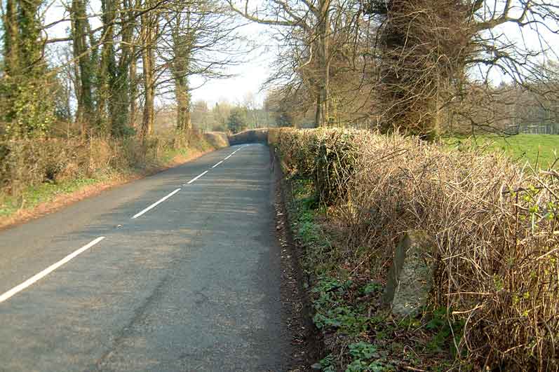
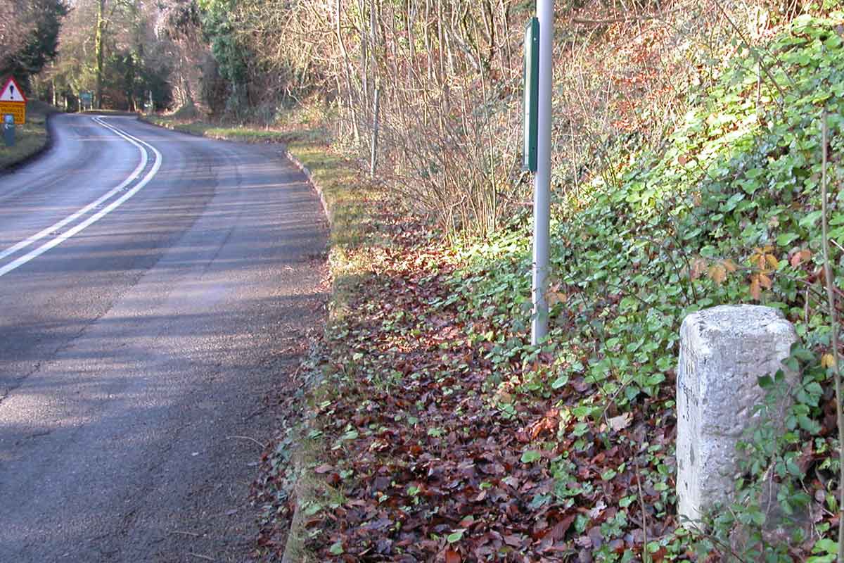
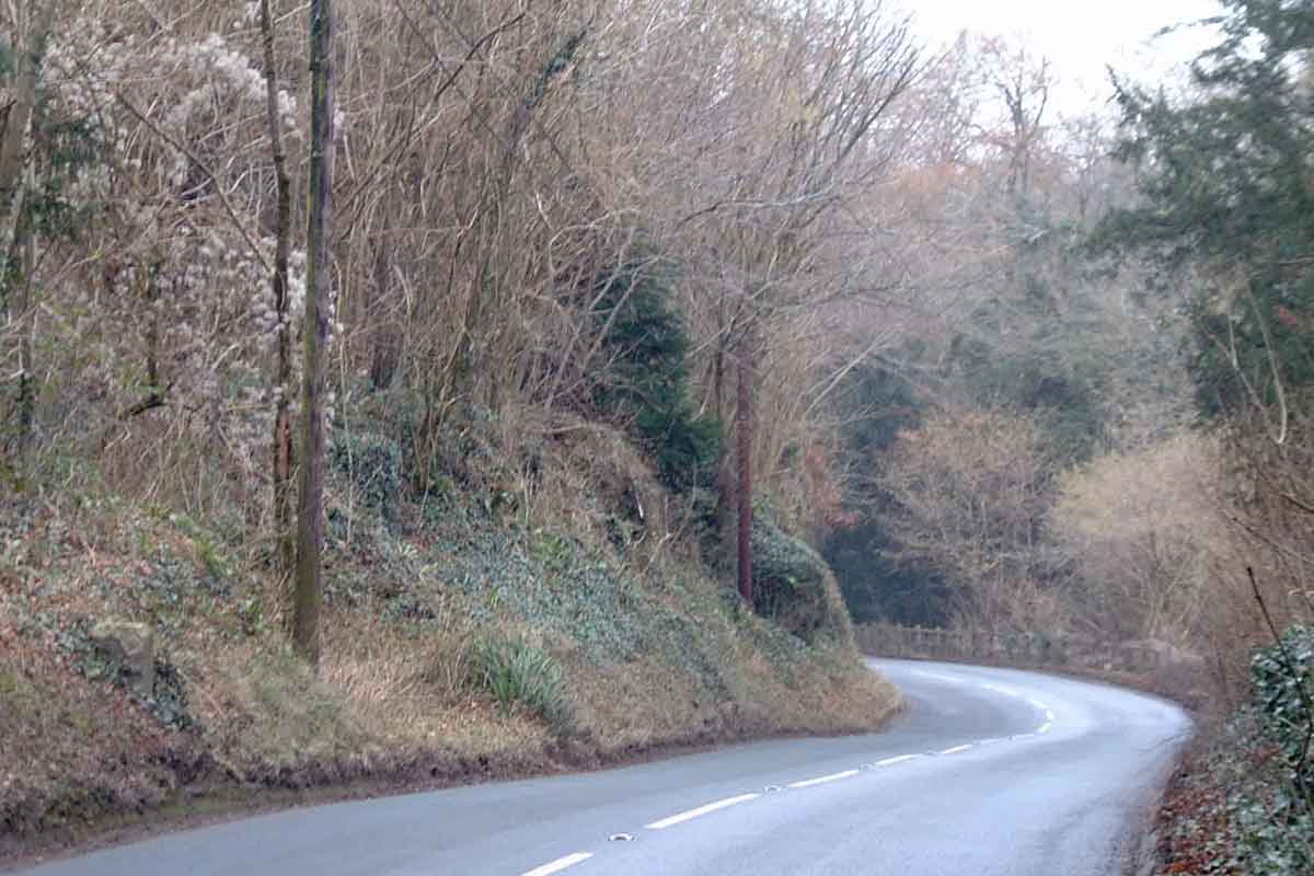
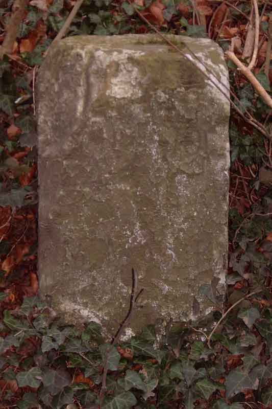
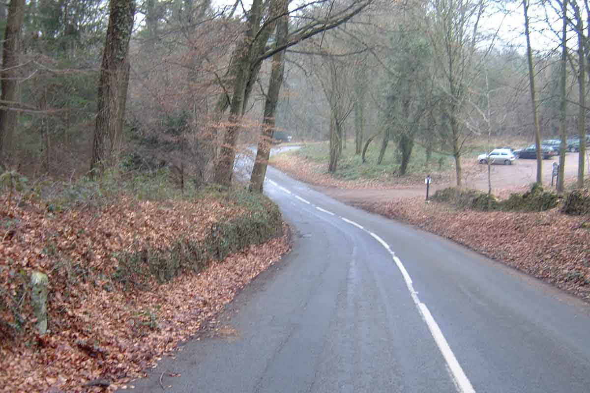
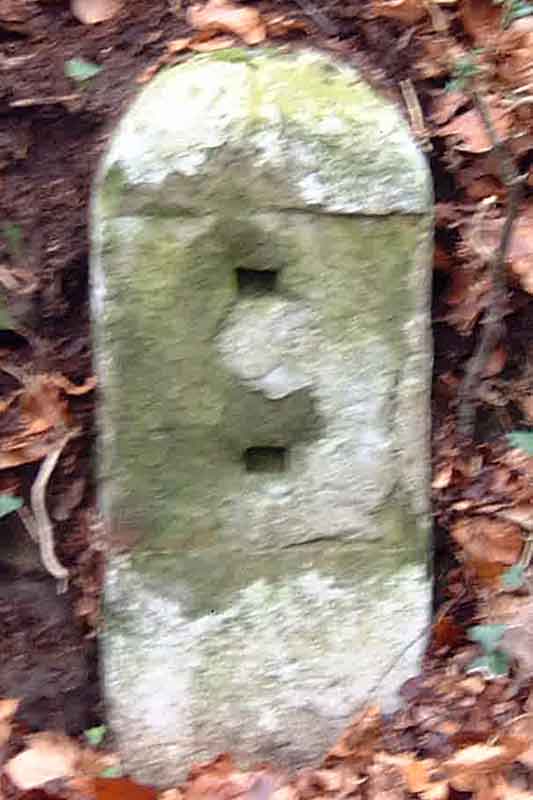
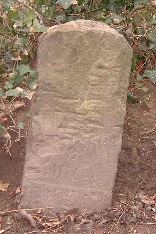
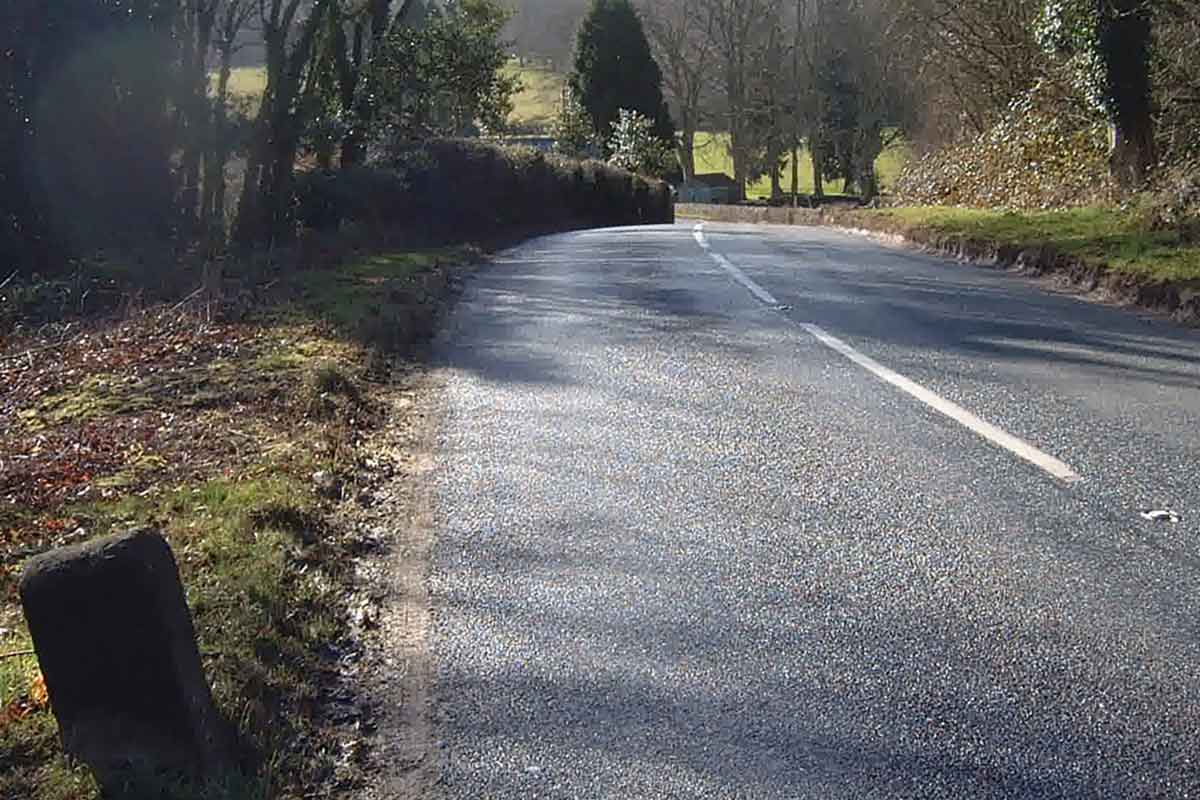
353456 199723 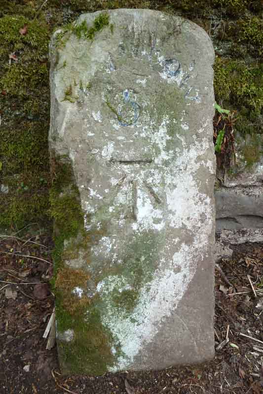 Originally fallen and almost buried under leaves and ivy. On the right verge just after leaving Tintern towards Chepstow. Originally fallen and almost buried under leaves and ivy. On the right verge just after leaving Tintern towards Chepstow.Sometime in early 2011, it was re-erected with the front face (shown) reading "Chepstow 5". The left-hand face shows the distance to Monmouth. 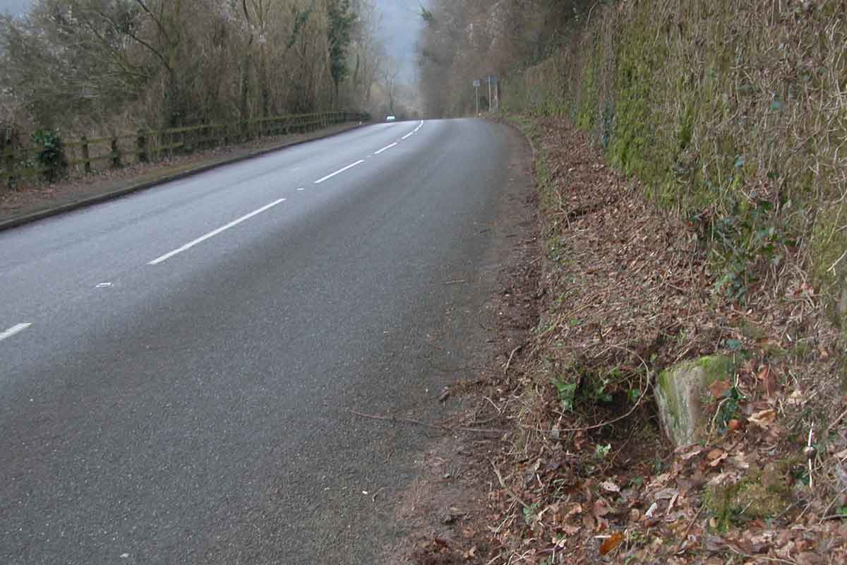 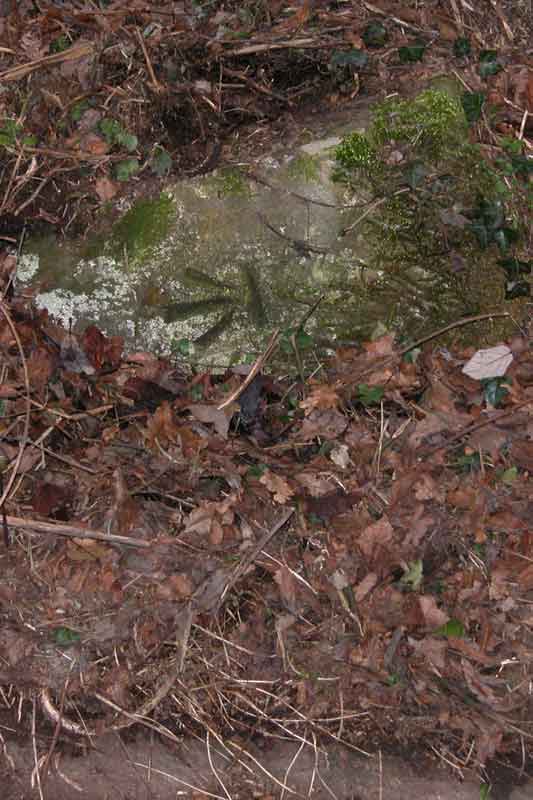 6
SO531007
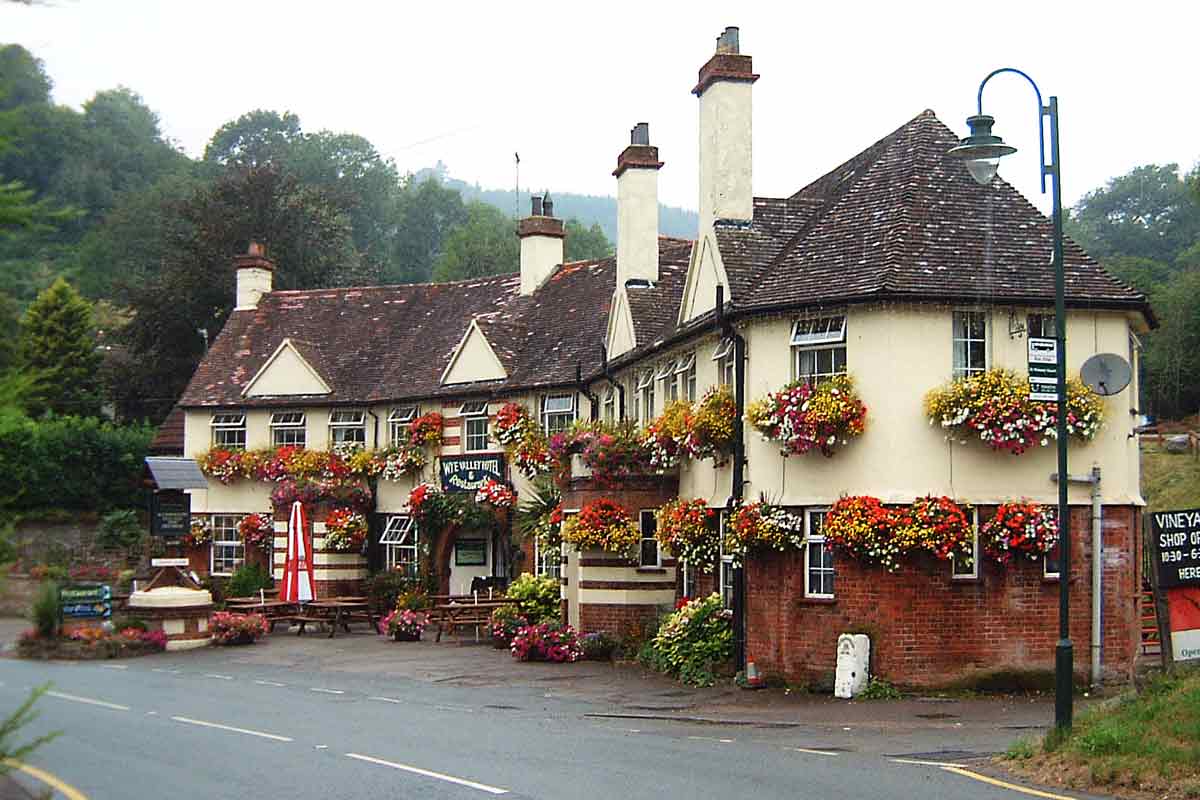
SO531007 Against the the wall of the Wye Valley Hotel in Tintern
B4293 St Arvans to Monmouth road via DevaudenMilestone
Location Grid Ref
Description
Location Photograph
Close-up Photo
1886 OS
Modern OS Explorer
Current Location
3
351061 197546
not on map
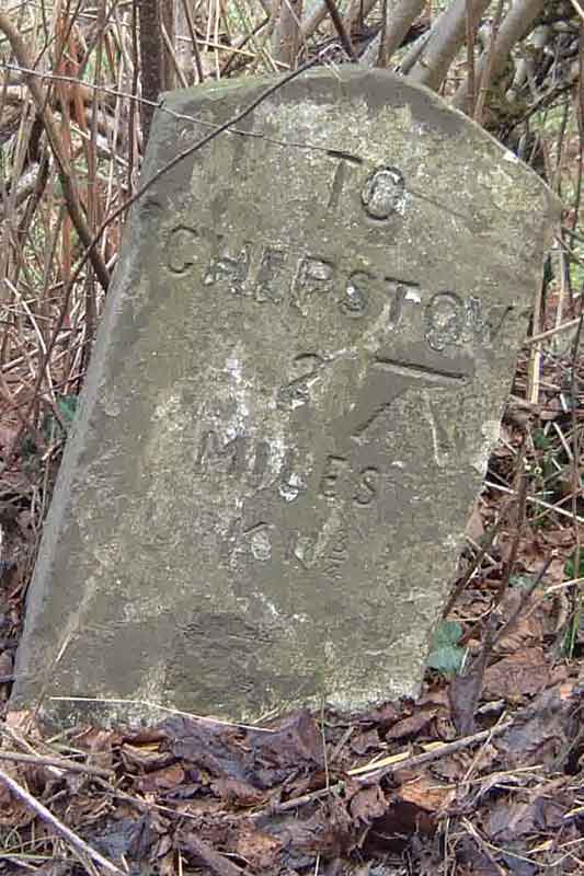
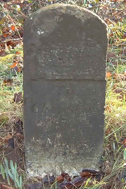
351061 197546 This milestone has for many years been covered with vegetation. The inscription reads "To Chepstow 3 Miles".
4
349976 198518
not on map
349976 198518 Plate missing.
5
348448 198861
348516 198760
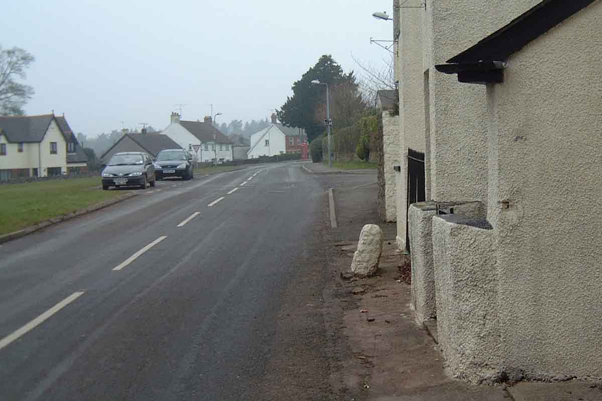
This mounting stone is located about where the milestone should be.
6
347986 200351
347950 200424
347950 200424 At New Inn. Partially buried obscuring the inscription " To Chepstow 6 Miles".
7
347456 201932
Presumably moved after 1886.
7½
347481 202763
1.5 miles from milestone 6. On the hill out of Llanishen towards Chepstow. Not located despite being on the current OS map.
8
347699 202968
347475 202771
9
348771 204200
10
349926 205179
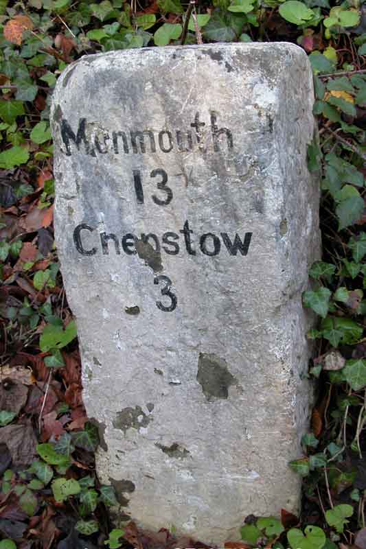
349683 204887 This milestone has been moved from its 1886 location. It is now on the left about ½ mile from Trellech travelling from Chepstow. The inscription has been damaged and is unreadable apart from the word "To". 3½ miles from the 6 mile stone at New Inn. Defaced.
11
350267 206591
350163 206207
The 1886 map shows this stone located just before the turn to Warren's Farm, going towards Trellech. 4 Miles to Monmouth. It is actually a quarter of a mile nearer to Trellech, a mile from milestone 10. Defaced.
12
This milestone should be located, a mile distant from the previous, on the verge opposite the former ostrich farm at OS 349952 207716
13
350220 209528
The 1886 map shows this stone on Lydart Hill, adjacent to Lydart House. 2 Miles to Monmouth. But if it has been moved subsequently, it should be located higher up outside Rock Cottage at OS 349917 209096
350056 209375
This stone is located at the Penallt turn on Lydart Hill. At a point about 3 miles from Agincourt Square, Monmouth. There may have been an inscription near the top. However, it is less than ½ mile from the 2 miles to Monmouth stone. It is not marked on the current OS Explorer map or the 1886 map.
14
350558 210240
This milestone is marked on the modern Explorer map just below the Lydart bends, near a mounting stone .
15
350757 211634
The 1886 map shows this stone at the Trothy Bridge. 1 Mile to Monmouth 137 miles to London.
B4293 Chepstow to Devauden via IttonB4235 Chepstow to Usk roadMilestone
Location Grid Ref
Description
Location Photograph
Close-up Photo
1886 OS
Modern OS Explorer
Current Location
1
not on map
not on map
2
not on map
ST506942
ST506942 3
not on map
ST494942
ST494942 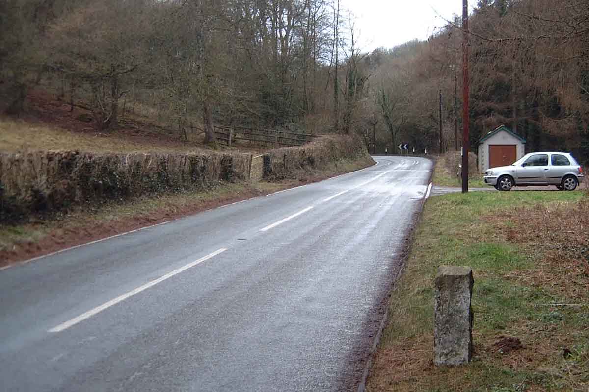 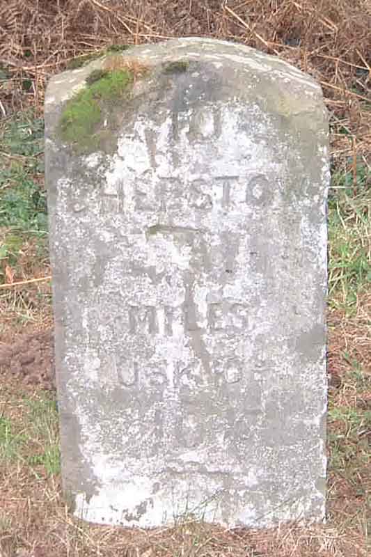 4
not on map
ST481944
ST481944  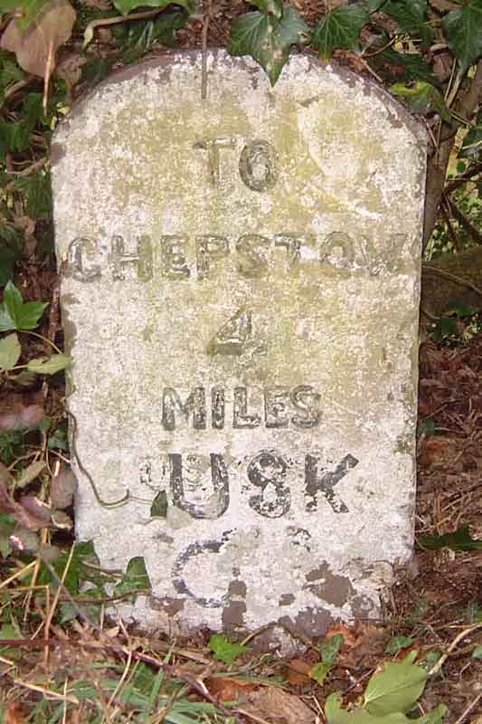 5
not on map
ST467948
6
not on map
ST457959
ST457959 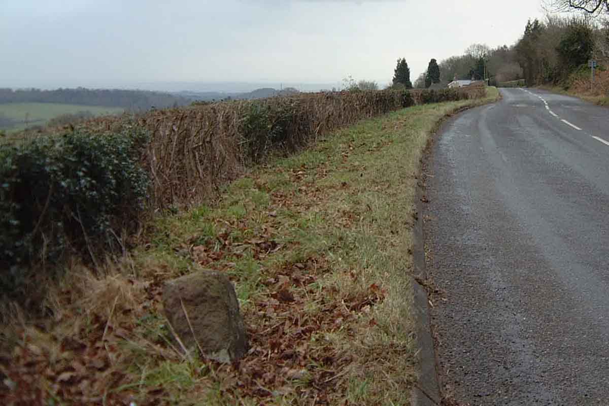 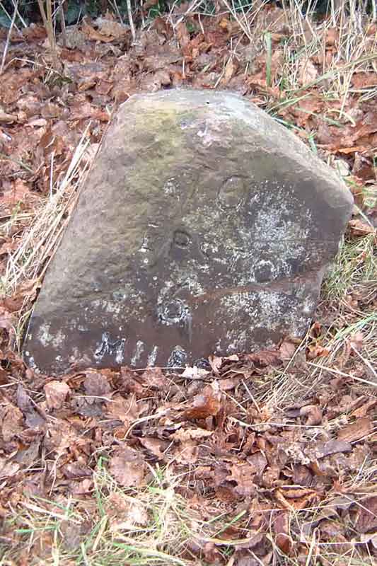 7
not on map
not on map
Appears to be missing
8
ST434975
9
not on map
10
SO418014
11
SO418014
12
SO407016
A48 Chepstow to Gloucester road.Milestone
Location Grid Ref
Description
Location Photograph
Close-up Photo
1891 OS
Modern OS Explorer
Current Location
1
353977 194679
not on map
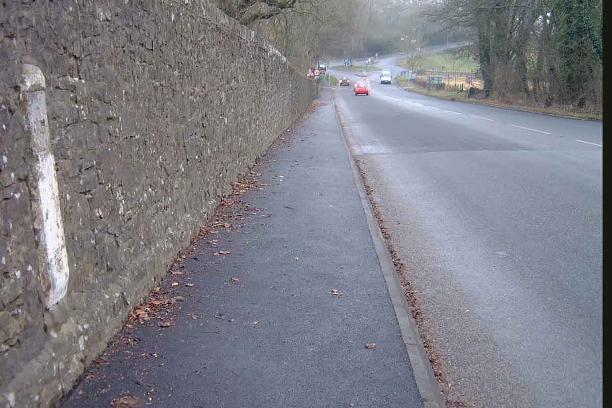
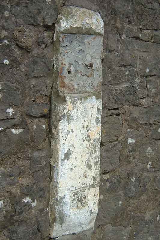
353935 194694 Perhaps the milestone against the wall of the Cross Keys Inn at Tutshill. (See B4228 to St Briavels)
2
355356 195334
On the Gloucester side of the Railway Bridge at Tidenham
3
356398 196543
4
357367 197843
Near the road junction in Stroat
5
358549 198877
On the Lydney side of Wyvern
6
359702 199941
7
360686 201109
360652 201101
Spotted on the left bank just before entering Alvington going towards Chepstow.
8
361965 201953
362137 202074
Should be at the Lydney end of Aylburton.
9
363110 203003
Chepstow end of Lydney
10
364302 203959
Cross Hands
11
365545 204981
365548 204981
on map 365548 204981 On the left between Blakeney and Lydney. Defaced.
12
366560 206164
Nibley green
13
367460 207133
On the hill entering Lydney from Gloucester
14
367657 208694
Underdean
15
368636 209796
Bullo
16
368700 211284
Close up against the railway bridge at Ruddle
17
369434 212336
400 yards the Gloucester side of Newnham GLS 10
370366 213812
370366 213812
Elton. Between the junction with the A4151 (Forest of Dean) and Gloucester the distances are to Gloucester. GLS 9
371596 214249
Westbury-on-Severn
GLS 8
372923 214060
Stantway
GLS 7
374289 214459
374350 214491
Chaxhill
GLS 6
375459 215445
375459 215445
Bottom of Hartland's Hill
GLS 5
376277 216678
376277 216678
GLS 4
377700 217154
377700 217154
Minsterworth
GLS 3
378985 217713
378985 217713
GLS 2
379561 219124
379563 219158
Highnam - Gloucester side of roundabout
GLS 1
381028 219440
381028 219440
Over
B4228 Chepstow to St Briavels road.Milestone
Location Grid Ref
Description
Location Photograph
Close-up Photo
1886 OS
Modern OS Explorer
Current Location
1
not on map
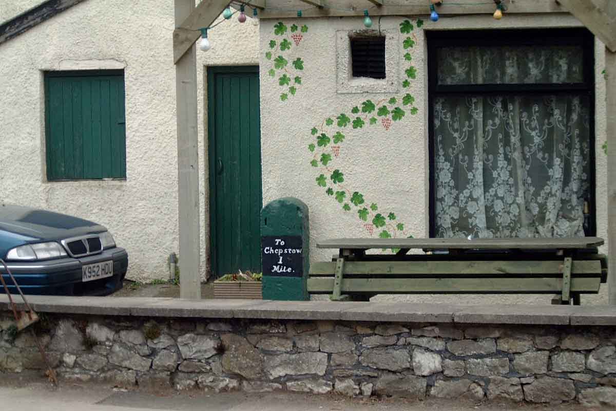
353935 194694 Against the wall of the Cross Keys Inn at Tutshill. Unusual colour, but it looks cared-for.
2
354273 195971
on map 354273 195971 The Rising Sun at Woodcroft is on the left in the distance towards Chepstow. Part of the inscription is just visible.
3
354900 197246
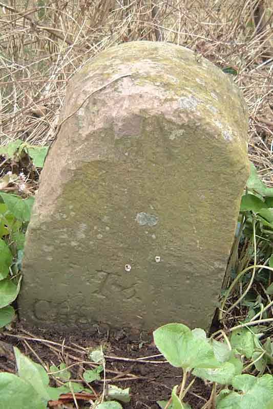
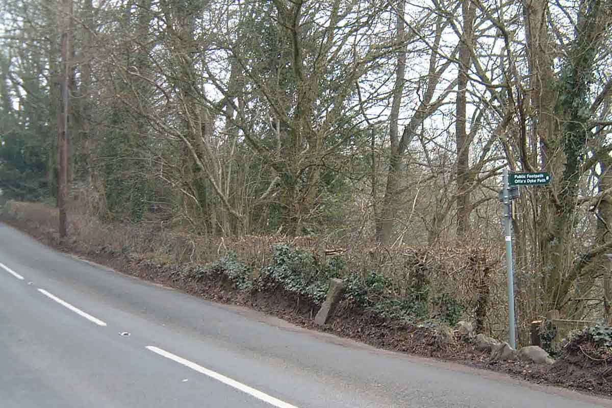
on map 354900 197246 This milestone is on the Offa's Dyke Long Distance Path. All that can be read is "3 miles". The top has been damaged, presumably by passing traffic.
4
355518 198660
on map Not found. Should be 200 metres north of the Miss Graces Lane junction.
5
355866 200153
on map 355866 200153 Madgett Cottages on the bend in the distance. The lettering is intact but hard to read owing to the mud splashed on the stone. Daffodils planted in front.
6
356456 201292
on map 7
356234 202836
on map Looking towards St Briavels.
  There is an excellent small book Called "Milestones" by Mervyn Benford which Shire Books publish at £4.99 ISBN 0-7478-0526-1. For further information on Chepstow's Turnpike Roads see "Turnpike Roads - The Chepstow and New Passgae Turnpike Districts" by Ivor Waters published 1985 ISBN 0906134315 An email would be appreciated if anyone can confirm the existence of a milestone. |
|
